[기상청 API] 날씨 불러오기: CORS error & Service key is not registered error
우와 이거 연결한다고 몇 시간을 쓴거야~~
우선 이러한 에러가 났던 나에게는 3가지의 문제가 있었다.
1. CORS error
웹에서 직접 요청을 보내면 발생한다.
프론트에서 직접 보내지 말고 백엔드에서 요청을 보내주면 해결된다.
나의 경우 Spring boot를 백엔드 프레임워크로 쓰고있어서 java를 이용했는데, 공공데이터포털에서 제공하는 샘플코드가 프레임워크를 전혀 쓰지 않은 코드라서... Spring boot에 맞게 GPT한테 잘 물어봐서 작성했다.
2. Error code 30: Service key is not registered
이거는 정말 오랫동안 애먹었는데, 서비스키도 정상적이고 디버깅으로 찍어본 요청 URL도 정상이었다. 이 에러가 뜨는 이유는 여러 가지가 있는데
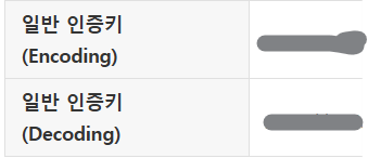
1) Encoded key를 사용하지 않은 경우
공공데이터포털에서 제공하는 2개의 서비스 키 중 Encoded 버전을 사용해야 한다.
2) Java 환경에서 service key를 그대로 요청 url에 때려박았을 경우
자바의 경우, 요청을 할 때 한번 더 인코딩을 한다고 한다(;;;)
따라서 아래와 같이 서비스 키를 URI 객체에 담아서 요청을 보내야 한다...
		// API 요청 URL 구성
            String url = String.format(
                    "%s?serviceKey=%s&pageNo=1&numOfRows=1000&dataType=JSON&base_date=%s&base_time=%s&nx=%d&ny=%d",
                    weatherApiBaseUrl, serviceKey, date, time, n[0], n[1]
            );

            // API 호출
            URI uri = new URI(url); // URI 객체 생성해서 변환
            ResponseEntity<Map> response = restTemplate.getForEntity(uri, Map.class);
이것 때문에 3시간은 손해봤다.
3) nx, ny는 단순 경도, 위도가 아니다
처음에 위, 경도인 줄 알았는데.. 공식 문서를 보니 그게 아니고 자체 좌표가 있었다.
일일히 mapping하는건 말이 안 되기 때문에 공식을 찾아보니 존재했다.
하단 코드는 해당 공식을 사용해서 위, 경도로부터 nx, ny값을 뽑아낸 코드.
request로는 위도와 경도를 받고, 해당 위, 경도로 계산한다.
	private static final double RE = 6371.00877; // 지구 반경 (km)
    private static final double GRID = 5.0; // 격자 간격 (km)
    private static final double SLAT1 = 30.0; // 투영 위도 1 (degree)
    private static final double SLAT2 = 60.0; // 투영 위도 2 (degree)
    private static final double OLON = 126.0; // 기준점 경도 (degree)
    private static final double OLAT = 38.0; // 기준점 위도 (degree)
    private static final double XO = 43; // 기준점 X 좌표
    private static final double YO = 136; // 기준점 Y 좌표

public static int[] convertToGrid(double lat, double lon) {
        double DEGRAD = Math.PI / 180.0;

        double re = RE / GRID;
        double slat1 = SLAT1 * DEGRAD;
        double slat2 = SLAT2 * DEGRAD;
        double olon = OLON * DEGRAD;
        double olat = OLAT * DEGRAD;

        double sn = Math.tan(Math.PI * 0.25 + slat2 * 0.5) / Math.tan(Math.PI * 0.25 + slat1 * 0.5);
        sn = Math.log(Math.cos(slat1) / Math.cos(slat2)) / Math.log(sn);
        double sf = Math.tan(Math.PI * 0.25 + slat1 * 0.5);
        sf = Math.pow(sf, sn) * Math.cos(slat1) / sn;
        double ro = Math.tan(Math.PI * 0.25 + olat * 0.5);
        ro = re * sf / Math.pow(ro, sn);

        double ra = Math.tan(Math.PI * 0.25 + lat * DEGRAD * 0.5);
        ra = re * sf / Math.pow(ra, sn);
        double theta = lon * DEGRAD - olon;
        if (theta > Math.PI) theta -= 2.0 * Math.PI;
        if (theta < -Math.PI) theta += 2.0 * Math.PI;
        theta *= sn;

        int x = (int) Math.floor(ra * Math.sin(theta) + XO + 0.5);
        int y = (int) Math.floor(ro - ra * Math.cos(theta) + YO + 0.5);

        return new int[]{x, y};
    }
3. 최종 요청 및 응답 코드 (Java)
package com.karim.karim.controller;

import io.swagger.v3.oas.annotations.Operation;
import io.swagger.v3.oas.annotations.tags.Tag;
import org.springframework.beans.factory.annotation.Value;
import org.springframework.http.HttpEntity;
import org.springframework.http.HttpHeaders;
import org.springframework.http.HttpMethod;
import org.springframework.http.ResponseEntity;
import org.springframework.web.bind.annotation.*;
import org.springframework.web.client.RestTemplate;

import java.net.URI;
import java.util.*;

@RestController
@RequestMapping("/weather")
@Tag(name = "Weather Controller", description = "기상청 날씨 요청 API")
public class WeatherController {

    @Value("${weather.api.base-url}")
    private String weatherApiBaseUrl;

    @Value("${weather.api.service-key}")
    private String serviceKey;

    private final RestTemplate restTemplate;

    private static final double RE = 6371.00877; // 지구 반경 (km)
    private static final double GRID = 5.0; // 격자 간격 (km)
    private static final double SLAT1 = 30.0; // 투영 위도 1 (degree)
    private static final double SLAT2 = 60.0; // 투영 위도 2 (degree)
    private static final double OLON = 126.0; // 기준점 경도 (degree)
    private static final double OLAT = 38.0; // 기준점 위도 (degree)
    private static final double XO = 43; // 기준점 X 좌표
    private static final double YO = 136; // 기준점 Y 좌표

    public static int[] convertToGrid(double lat, double lon) { // 위, 경도를 기준점 좌표로 변환하는 함수
        double DEGRAD = Math.PI / 180.0;

        double re = RE / GRID;
        double slat1 = SLAT1 * DEGRAD;
        double slat2 = SLAT2 * DEGRAD;
        double olon = OLON * DEGRAD;
        double olat = OLAT * DEGRAD;

        double sn = Math.tan(Math.PI * 0.25 + slat2 * 0.5) / Math.tan(Math.PI * 0.25 + slat1 * 0.5);
        sn = Math.log(Math.cos(slat1) / Math.cos(slat2)) / Math.log(sn);
        double sf = Math.tan(Math.PI * 0.25 + slat1 * 0.5);
        sf = Math.pow(sf, sn) * Math.cos(slat1) / sn;
        double ro = Math.tan(Math.PI * 0.25 + olat * 0.5);
        ro = re * sf / Math.pow(ro, sn);

        double ra = Math.tan(Math.PI * 0.25 + lat * DEGRAD * 0.5);
        ra = re * sf / Math.pow(ra, sn);
        double theta = lon * DEGRAD - olon;
        if (theta > Math.PI) theta -= 2.0 * Math.PI;
        if (theta < -Math.PI) theta += 2.0 * Math.PI;
        theta *= sn;

        int x = (int) Math.floor(ra * Math.sin(theta) + XO + 0.5);
        int y = (int) Math.floor(ro - ra * Math.cos(theta) + YO + 0.5);

        return new int[]{x, y};
    }

    public WeatherController(RestTemplate restTemplate) {
        this.restTemplate = restTemplate;
    }

    @Operation(summary = "초단기실황 조회", description = "1시간 단위로 실시간 날씨를 조회합니다.")
    @GetMapping()
    public ResponseEntity<Object> getWeather(
            @RequestParam("date") String date,
            @RequestParam("time") String time,
            @RequestParam("nx") double nx,
            @RequestParam("ny") double ny
    ) {
        try {
            int[] n = convertToGrid(nx, ny);

            // API 요청 URL 구성
            String url = String.format(
                    "%s?serviceKey=%s&pageNo=1&numOfRows=1000&dataType=JSON&base_date=%s&base_time=%s&nx=%d&ny=%d",
                    weatherApiBaseUrl, serviceKey, date, time, n[0], n[1]
            );

            // API 호출
            URI uri = new URI(url);
            ResponseEntity<Map> response = restTemplate.getForEntity(uri, Map.class);

            // 필요한 항목들 추출
            Map<String, Object> responseBody = (Map<String, Object>) response.getBody().get("response");
            Map<String, Object> responseBody2 = (Map<String, Object>) responseBody.get("body");
            Map<String, Object> items = (Map<String, Object>) responseBody2.get("items");
            List<Map<String, Object>> itemList = (List<Map<String, Object>>) items.get("item");

            // 추출된 데이터를 담을 Map 생성
            Map<String, Object> weatherData = new HashMap<>();
            Double temperature = null; // 기온
            Integer humidity = null; // 습도
            Double perceivedTemperature = null; // 체감기온
            Double windSpeed = null; // 풍속
            String weatherStatus = null; // 날씨 상태

            // 아이템을 순회하며 필요한 데이터 추출
            for (Map<String, Object> item : itemList) {
                String category = (String) item.get("category");
                Object obsrValue = item.get("obsrValue");

                // 기온(T1H)
                if ("T1H".equals(category)) {
                    temperature = Double.parseDouble(obsrValue.toString());
                }
                // 습도(REH)
                if ("REH".equals(category)) {
                    humidity = Integer.parseInt(obsrValue.toString());
                }
                // 날씨 상태 (PTY)
                if ("PTY".equals(category)) {
                    weatherStatus = getWeatherStatus(Integer.parseInt(obsrValue.toString()));
                }
                // 풍속(WSD)
                if ("WSD".equals(category)) {
                    windSpeed = Double.parseDouble(obsrValue.toString());
                }
            }

            // 체감기온 계산 (기온과 풍속이 모두 있을 때, 공식 이용)
            if (temperature != null && windSpeed != null) {
                perceivedTemperature = 13.12 + 0.6215 * temperature - 11.37 * Math.pow(windSpeed, 0.16) + 0.3965 * temperature * Math.pow(windSpeed, 0.16);
                perceivedTemperature = Math.round(perceivedTemperature * 100.0) / 100.0; // 소수점 두 자리까지 반올림
            }

            // 추출된 데이터를 JSON 형식으로 리턴할 Map에 저장
            weatherData.put("temperature", temperature);
            weatherData.put("humidity", humidity);
            weatherData.put("perceivedTemperature", perceivedTemperature);
            weatherData.put("weatherStatus", weatherStatus);

            // 응답을 JSON 형식으로 반환
            return ResponseEntity.ok(weatherData); // Map을 JSON으로 자동 변환하여 리턴
        } catch (Exception e) {
            // 에러 처리
            Map<String, String> errorResponse = new HashMap<>();
            errorResponse.put("error", "Weather API 호출 중 문제가 발생했습니다.");
            errorResponse.put("message", e.getMessage());
            return ResponseEntity.status(500).body(errorResponse);
        }
    }

    // 날씨 상태를 숫자 코드로부터 실제 날씨 상태 문자열로 변환
    private String getWeatherStatus(int code) {
        return switch (code) {
            case 0 -> "맑음";
            case 1 -> "구름 조금";
            case 2 -> "구름 많음";
            case 3 -> "흐림";
            case 4 -> "비";
            case 5 -> "비/눈";
            case 6 -> "눈";
            case 7 -> "소나기";
            default -> "알 수 없음";
        };
    }
}
해당 코드를 실행하면 api 요청 결과는 다음과 같이 나온다.
